
Thank you for supporting this site ❤️
Make a donation
Make a donation
Gear up for your next adventure:
As an Amazon Associate, this site earns from qualifying purchases at no extra cost to you.
Daylesford topographic map
Click on the map to display elevation.
Thank you for supporting this site ❤️
Make a donation
Make a donation
Gear up for your next adventure:
As an Amazon Associate, this site earns from qualifying purchases at no extra cost to you.
About this map
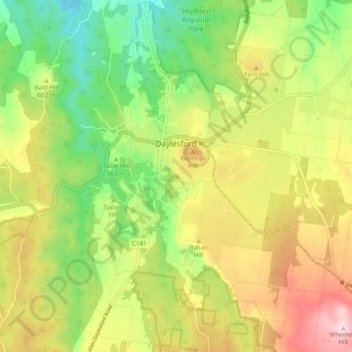
Name: Daylesford topographic map, elevation, terrain.
Location: Daylesford, Shire of Hepburn, Victoria, 3460, Australia (-37.38550 144.09549 -37.31171 144.19184)
Average elevation: 1,926 ft
Minimum elevation: 1,388 ft
Maximum elevation: 2,605 ft
Thank you for supporting this site ❤️
Make a donation
Make a donation
Gear up for your next adventure:
As an Amazon Associate, this site earns from qualifying purchases at no extra cost to you.