
Thank you for supporting this site ❤️
Make a donation
Make a donation
Gear up for your next adventure:
As an Amazon Associate, this site earns from qualifying purchases at no extra cost to you.
Kaiseraugst topographic map
Click on the map to display elevation.
Thank you for supporting this site ❤️
Make a donation
Make a donation
Gear up for your next adventure:
As an Amazon Associate, this site earns from qualifying purchases at no extra cost to you.
About this map
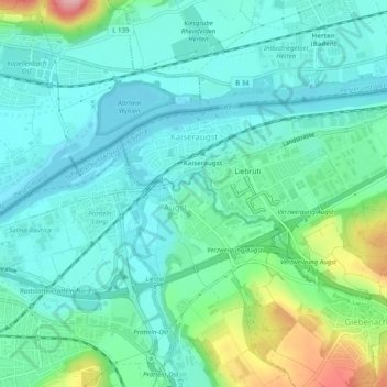
Name: Kaiseraugst topographic map, elevation, terrain.
Location: Kaiseraugst, Bezirk Rheinfelden, Aargau, 4303, Switzerland (47.52499 7.71353 47.54630 7.76356)
Average elevation: 958 ft
Minimum elevation: 846 ft
Maximum elevation: 1,352 ft
Thank you for supporting this site ❤️
Make a donation
Make a donation
Gear up for your next adventure:
As an Amazon Associate, this site earns from qualifying purchases at no extra cost to you.