
Copihue topographic map
Interactive map
Click on the map to display elevation.
About this map
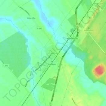
Name: Copihue topographic map, elevation, terrain.
Location: Copihue, Provincia de Linares, Región del Maule, Chile (-36.11001 -71.81916 -36.07001 -71.77916)
Average elevation: 531 ft
Minimum elevation: 469 ft
Maximum elevation: 643 ft