
Ham-sur-Sambre topographic map
Interactive map
Click on the map to display elevation.
About this map
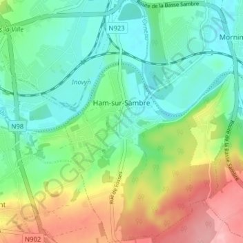
Name: Ham-sur-Sambre topographic map, elevation, terrain.
Location: Ham-sur-Sambre, Jemeppe-sur-Sambre, Namur, Wallonie, Belgique (50.42091 4.65843 50.46174 4.69362)
Average elevation: 423 ft
Minimum elevation: 272 ft
Maximum elevation: 712 ft