
Tha Muang topographic map
Interactive map
Click on the map to display elevation.
About this map
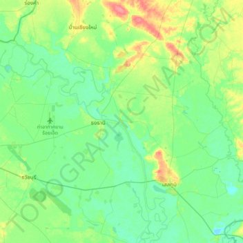
Name: Tha Muang topographic map, elevation, terrain.
Location: Tha Muang, Roi Et Province, Thailand (15.95371 103.71289 16.27371 104.03289)
Average elevation: 456 ft
Minimum elevation: 404 ft
Maximum elevation: 591 ft
Other topographic maps
Click on a map to view its topography, its elevation and its terrain.
Ban Nong Ko
Thailand > Roi Et Province > Ban Nong Ko
Ban Nong Ko, Roi Et Province, Thailand
Average elevation: 518 ft
Ban Chan
Thailand > Roi Et Province > Ban Chan
Ban Chan, Roi Et Province, Thailand
Average elevation: 436 ft