
Pico Torres topographic map
Interactive map
Click on the map to display elevation.
About this map
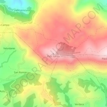
Name: Pico Torres topographic map, elevation, terrain.
Location: Pico Torres, Villaviciosa, Astúrias, Espanha (43.41589 -5.49686 43.41599 -5.49676)
Average elevation: 1,306 ft
Minimum elevation: 574 ft
Maximum elevation: 1,890 ft