
Τάλα topographic map
Interactive map
Click on the map to display elevation.
About this map
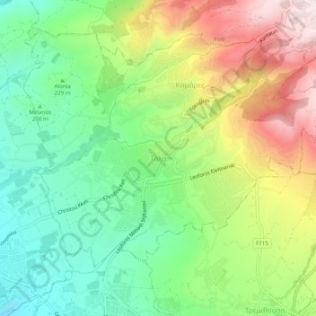
Name: Τάλα topographic map, elevation, terrain.
Location: Τάλα, Κοινότητα Τάλας, Paphos, Chypre, 8577, Chypre (34.81613 32.41098 34.85613 32.45098)
Average elevation: 938 ft
Minimum elevation: 184 ft
Maximum elevation: 2,090 ft