
Redu topographic map
Interactive map
Click on the map to display elevation.
About this map
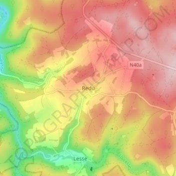
Name: Redu topographic map, elevation, terrain.
Location: Redu, Neufchâteau, Luxembourg, Wallonie, Belgique (49.98779 5.14018 50.02779 5.18018)
Average elevation: 1,198 ft
Minimum elevation: 745 ft
Maximum elevation: 1,499 ft