
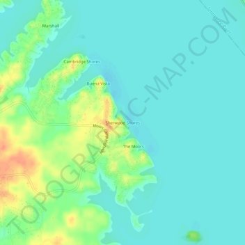
Sherwood Shores topographic map
Interactive map
Click on the map to display elevation.
About this map
Name: Sherwood Shores topographic map, elevation, terrain.
Average elevation: 374 ft
Minimum elevation: 338 ft
Maximum elevation: 472 ft
Other topographic maps
Click on a map to view its topography, its elevation and its terrain.
Calvert City
United States > Kentucky > Marshall County
Calvert City, Marshall County, Kentucky, 42029, United States
Average elevation: 367 ft
Benton
United States > Kentucky > Marshall County > Benton
Benton, Marshall County, Kentucky, United States
Average elevation: 433 ft
Draffenville
United States > Kentucky > Marshall County
Draffenville, Marshall County, Kentucky, United States
Average elevation: 446 ft