
Villa Verde topographic map
Interactive map
Click on the map to display elevation.
About this map
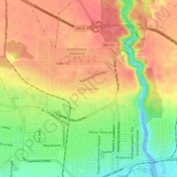
Name: Villa Verde topographic map, elevation, terrain.
Location: Villa Verde, La Romana, República Dominicana (18.41657 -68.99570 18.45657 -68.95570)
Average elevation: 148 ft
Minimum elevation: -26 ft
Maximum elevation: 256 ft
Other topographic maps
Click on a map to view its topography, its elevation and its terrain.
Isla Catalina
República Dominicana > La Romana > La Romana
Isla Catalina, La Romana, República Dominicana
Average elevation: 7 ft