
Thank you for supporting this site ❤️
Make a donation
Make a donation
Gear up for your next adventure:
As an Amazon Associate, this site earns from qualifying purchases at no extra cost to you.
Guissona topographic map
Click on the map to display elevation.
Thank you for supporting this site ❤️
Make a donation
Make a donation
Gear up for your next adventure:
As an Amazon Associate, this site earns from qualifying purchases at no extra cost to you.
About this map
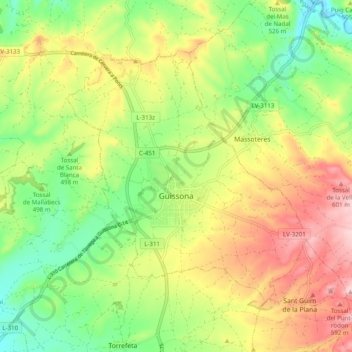
Name: Guissona topographic map, elevation, terrain.
Location: Guissona, Segarra, Catalonia, 25210, Spain (41.76295 1.22690 41.81564 1.32532)
Average elevation: 1,637 ft
Minimum elevation: 1,329 ft
Maximum elevation: 2,021 ft
Thank you for supporting this site ❤️
Make a donation
Make a donation
Gear up for your next adventure:
As an Amazon Associate, this site earns from qualifying purchases at no extra cost to you.