
Robledo topographic map
Interactive map
Click on the map to display elevation.
About this map
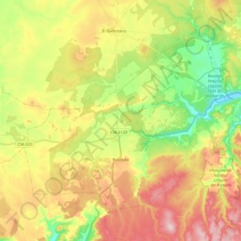
Name: Robledo topographic map, elevation, terrain.
Location: Robledo, Albacete, Castela-Mancha, Espanha (38.72383 -2.52976 38.84292 -2.32945)
Average elevation: 3,330 ft
Minimum elevation: 2,949 ft
Maximum elevation: 3,753 ft