
华亭市 topographic map
Interactive map
Click on the map to display elevation.
About this map
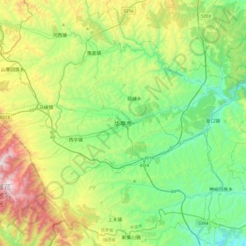
Name: 华亭市 topographic map, elevation, terrain.
Location: 华亭市, 东华街道, 华亭市, 平凉市, 甘肃省, 中国 (35.05829 106.48929 35.37829 106.80929)
Average elevation: 5,377 ft
Minimum elevation: 3,842 ft
Maximum elevation: 8,921 ft