
Paulushof topographic map
Interactive map
Click on the map to display elevation.
About this map
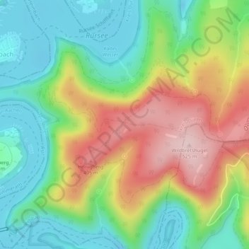
Name: Paulushof topographic map, elevation, terrain.
Average elevation: 1,230 ft
Minimum elevation: 909 ft
Maximum elevation: 1,719 ft
Other topographic maps
Click on a map to view its topography, its elevation and its terrain.
Mariawald
Deutschland > Nordrhein-Westfalen > Kreis Düren > Heimbach
Mariawald, Heimbach, Kreis Düren, Nordrhein-Westfalen, 52396, Deutschland
Average elevation: 1,247 ft