
Lourenzá topographic map
Interactive map
Click on the map to display elevation.
About this map
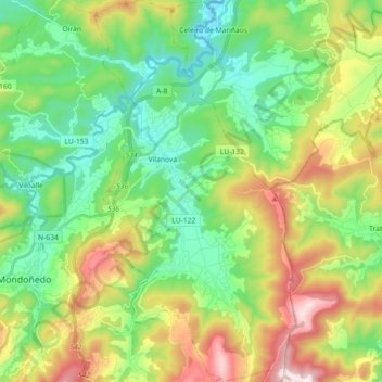
Name: Lourenzá topographic map, elevation, terrain.
Location: Lourenzá, Mariña Central, Lugo, Galicia, España (43.39445 -7.33055 43.52535 -7.23527)
Average elevation: 853 ft
Minimum elevation: 10 ft
Maximum elevation: 2,493 ft
Other topographic maps
Click on a map to view its topography, its elevation and its terrain.