Ballon d'Alsace topographic map
Interactive map
Click on the map to display elevation.
About this map
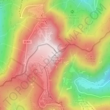
Name: Ballon d'Alsace topographic map, elevation, terrain.
Average elevation: 3,261 ft
Minimum elevation: 2,142 ft
Maximum elevation: 4,085 ft

Click on the map to display elevation.
Name: Ballon d'Alsace topographic map, elevation, terrain.
Average elevation: 3,261 ft
Minimum elevation: 2,142 ft
Maximum elevation: 4,085 ft