
Matane topographic map
Interactive map
Click on the map to display elevation.
About this map
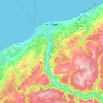
Name: Matane topographic map, elevation, terrain.
Location: Matane, La Matanie, Bas-Saint-Laurent, Québec, Canada (48.71791 -67.62290 48.87945 -67.34242)
Average elevation: 354 ft
Minimum elevation: -3 ft
Maximum elevation: 1,027 ft