Alfândega da Fé topographic map
Interactive map
Click on the map to display elevation.
About this map
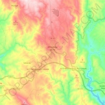
Name: Alfândega da Fé topographic map, elevation, terrain.
Average elevation: 1,509 ft
Minimum elevation: 630 ft
Maximum elevation: 2,303 ft

Click on the map to display elevation.
Name: Alfândega da Fé topographic map, elevation, terrain.
Average elevation: 1,509 ft
Minimum elevation: 630 ft
Maximum elevation: 2,303 ft