
Tondela topographic map
Interactive map
Click on the map to display elevation.
About this map
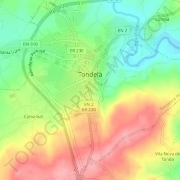
Name: Tondela topographic map, elevation, terrain.
Location: Tondela, Viseu, Viseu Dão-Lafões, Centro, Portugal (40.50046 -8.09388 40.52762 -8.06638)
Average elevation: 994 ft
Minimum elevation: 807 ft
Maximum elevation: 1,201 ft