
Ponte della Pietra topographic map
Interactive map
Click on the map to display elevation.
About this map
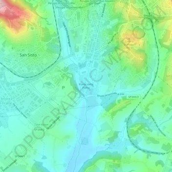
Name: Ponte della Pietra topographic map, elevation, terrain.
Location: Ponte della Pietra, San Sisto, Perugia, Umbria, 06129, Italia (43.05778 12.34481 43.09778 12.38481)
Average elevation: 932 ft
Minimum elevation: 745 ft
Maximum elevation: 1,529 ft