
Gunjur Palya Lake topographic map
Interactive map
Click on the map to display elevation.
About this map
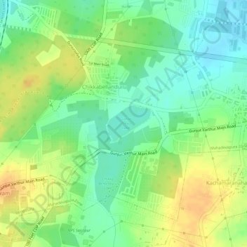
Name: Gunjur Palya Lake topographic map, elevation, terrain.
Average elevation: 2,904 ft
Minimum elevation: 2,844 ft
Maximum elevation: 2,959 ft
Other topographic maps
Click on a map to view its topography, its elevation and its terrain.
Kachamaranahalli
India > Karnataka > Bangalore East > Kachamaranahalli
Kachamaranahalli, Bangalore East, Bangalore Urban, Karnataka, 560087, India
Average elevation: 2,917 ft