
Tenmile topographic map
Interactive map
Click on the map to display elevation.
About this map
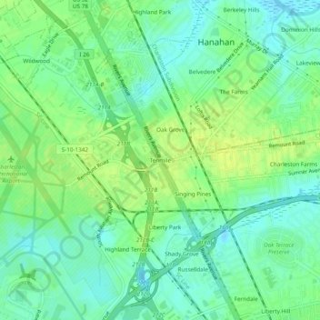
Name: Tenmile topographic map, elevation, terrain.
Location: Tenmile, Charleston County, South Carolina, 29416, USA (32.87910 -80.03719 32.91910 -79.99719)
Average elevation: 30 ft
Minimum elevation: -7 ft
Maximum elevation: 59 ft