
Thank you for supporting this site ❤️
Make a donation
Make a donation
Gear up for your next adventure:
As an Amazon Associate, this site earns from qualifying purchases at no extra cost to you.
Kozloduy topographic map
Click on the map to display elevation.
Thank you for supporting this site ❤️
Make a donation
Make a donation
Gear up for your next adventure:
As an Amazon Associate, this site earns from qualifying purchases at no extra cost to you.
About this map
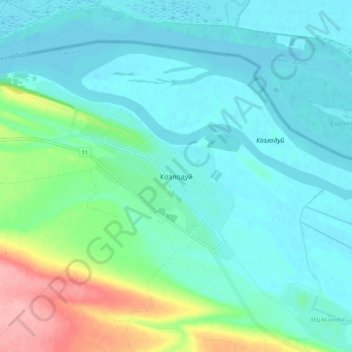
Name: Kozloduy topographic map, elevation, terrain.
Location: Kozloduy, Kozlodui, Vratsa, 3320, Bulgaria (43.73509 23.68933 43.81509 23.76933)
Average elevation: 171 ft
Minimum elevation: 82 ft
Maximum elevation: 495 ft
Thank you for supporting this site ❤️
Make a donation
Make a donation
Gear up for your next adventure:
As an Amazon Associate, this site earns from qualifying purchases at no extra cost to you.