
Pratāpgarh topographic map
Interactive map
Click on the map to display elevation.
About this map
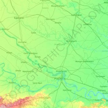
Name: Pratāpgarh topographic map, elevation, terrain.
Location: Pratāpgarh, Pratapgarh, Uttar Pradesh, India (25.05000 81.05000 26.45000 82.45000)
Average elevation: 338 ft
Minimum elevation: 210 ft
Maximum elevation: 968 ft
Other topographic maps
Click on a map to view its topography, its elevation and its terrain.
Raniganj
India > Uttar Pradesh > Pratāpgarh
Raniganj, Pratapgarh, Uttar Pradesh, India
Average elevation: 308 ft
.1
India > Uttar Pradesh > Pratāpgarh
.1, Kunda, Pratapgarh, Uttar Pradesh, 229408, India
Average elevation: 348 ft
Lalganj
India > Uttar Pradesh > Pratāpgarh
Lalganj, Pratapgarh, Uttar Pradesh, India
Average elevation: 338 ft