
Jardines de la Silla topographic map
Interactive map
Click on the map to display elevation.
About this map
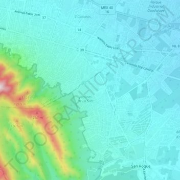
Name: Jardines de la Silla topographic map, elevation, terrain.
Location: Jardines de la Silla, Juárez, Nuevo León, 67188, México (25.59150 -100.22419 25.67150 -100.14419)
Average elevation: 1,870 ft
Minimum elevation: 1,362 ft
Maximum elevation: 4,783 ft