
Isla Seymour Norte topographic map
Interactive map
Click on the map to display elevation.
About this map
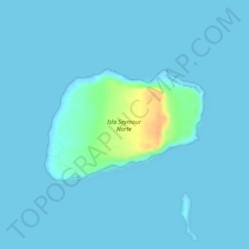
Name: Isla Seymour Norte topographic map, elevation, terrain.
Average elevation: 13 ft
Minimum elevation: 0 ft
Maximum elevation: 121 ft
Other topographic maps
Click on a map to view its topography, its elevation and its terrain.
Parque Nacional Galápagos
Ecuador > Galápagos > Parroquia Santa Rosa
Parque Nacional Galápagos, Troncal Insular, Parroquia Santa Rosa, Cantón Santa Cruz, Galápagos, Ecuador
Average elevation: 56 ft