
Buchhorst topographic map
Interactive map
Click on the map to display elevation.
About this map
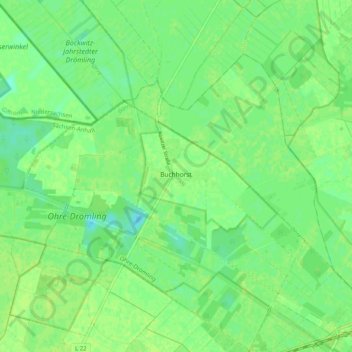
Name: Buchhorst topographic map, elevation, terrain.
Average elevation: 190 ft
Minimum elevation: 167 ft
Maximum elevation: 203 ft
Other topographic maps
Click on a map to view its topography, its elevation and its terrain.
Weferlingen
Deutschland > Sachsen-Anhalt > Oebisfelde-Weferlingen > Weferlingen
Weferlingen, Oebisfelde-Weferlingen, Börde, Sachsen-Anhalt, 39356, Deutschland
Average elevation: 341 ft
Lockstedt
Deutschland > Sachsen-Anhalt > Oebisfelde-Weferlingen
Lockstedt, Oebisfelde-Weferlingen, Börde, Sachsen-Anhalt, Deutschland
Average elevation: 226 ft