Geolocate

Songshan District topographic map

Click on the map to display elevation.

About this map

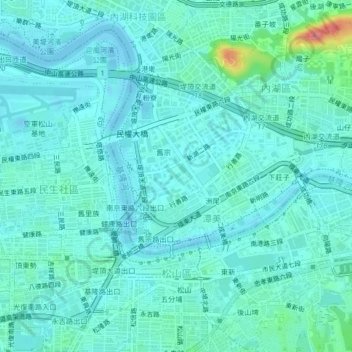
Name: Songshan District topographic map, elevation, terrain.

Location: Songshan District, Tanmei, Taipei, Taiwan (25.04437 121.53845 25.07583 121.58008)

Average elevation: 43 ft

Minimum elevation: -20 ft

Maximum elevation: 276 ft

Gear up for your next adventure:

🎁Geography Themed Gifts - Unique gift ideas for map lovers and geography enthusiasts
📶Vehicle Signal Boosters - Improve reception in rural areas while driving to trailheads
🪓Survival Multi‑Tool - Versatile tool for camp and trail tasks
📷Action Cameras - Rugged cameras to document your journeys across rugged terrain
🌡️Portable Weather Meter - Track weather conditions on the trail

As an Amazon Associate, this site earns from qualifying purchases at no extra cost to you.