
Hofheim am Taunus topographic map
Interactive map
Click on the map to display elevation.
About this map
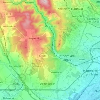
Name: Hofheim am Taunus topographic map, elevation, terrain.
Location: Hofheim am Taunus, Main-Taunus-Kreis, Hesse, 65719, Germany (50.04567 8.34367 50.14248 8.47422)
Average elevation: 650 ft
Minimum elevation: 289 ft
Maximum elevation: 1,444 ft