
Thank you for supporting this site ❤️
Make a donation
Make a donation
Gear up for your next adventure:
As an Amazon Associate, this site earns from qualifying purchases at no extra cost to you.
Blakeney topographic map
Click on the map to display elevation.
Thank you for supporting this site ❤️
Make a donation
Make a donation
Gear up for your next adventure:
As an Amazon Associate, this site earns from qualifying purchases at no extra cost to you.
About this map
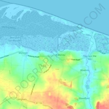
Name: Blakeney topographic map, elevation, terrain.
Location: Blakeney, North Norfolk, Norfolk, England, United Kingdom (52.92640 0.95493 52.98176 1.03163)
Average elevation: 46 ft
Minimum elevation: -16 ft
Maximum elevation: 203 ft
Thank you for supporting this site ❤️
Make a donation
Make a donation
Gear up for your next adventure:
As an Amazon Associate, this site earns from qualifying purchases at no extra cost to you.