Geolocate

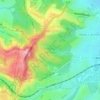
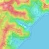
Newcastle topographic map

Click on the map to display elevation.

About this map
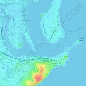
Name: Newcastle topographic map, elevation, terrain.

Location: Newcastle, Newcastle-Maitland, New South Wales, 2300, Australia (-32.93781 151.75963 -32.90148 151.80393)

Average elevation: 16 ft

Minimum elevation: -10 ft

Maximum elevation: 249 ft

Other topographic maps

Click on a map to view its topography, its elevation and its terrain.
Newcastle Beach

Australia > New South Wales > Newcastle

Average elevation: 23 ft

Blackbutt Reserve

Australia > New South Wales > Newcastle

Average elevation: 210 ft

Jesmond Park

Australia > New South Wales > Newcastle

Average elevation: 115 ft

Redhead Bluff

Australia > New South Wales > Newcastle

Average elevation: 43 ft

Cameron Park

Australia > New South Wales > Newcastle

Average elevation: 75 ft

King Edward Park

Australia > New South Wales > Newcastle

Average elevation: 26 ft

Glenrock Lagoon

Australia > New South Wales > Newcastle

Average elevation: 128 ft

Merewether Beach

Australia > New South Wales > Newcastle

Average elevation: 39 ft

Nobbys Beach

Australia > New South Wales > Newcastle

Average elevation: 10 ft

Dixon Park

Australia > New South Wales > Newcastle

Average elevation: 39 ft

Stockton Beach

Australia > New South Wales > Newcastle

Average elevation: 13 ft

Gear up for your next adventure:

🛰️Handheld GPS Units - Professional satellite navigators for precise backcountry mapping
🔥Plasma Lighters - Windproof lighters that work in any weather condition
🕶️GPS Smartphone Mount - Secure mount for phone navigation
🧣Merino Neck Gaiters - Multi-functional headwear for wind and sun protection
🌡️Handheld Weather Meters - Measure wind, temp, and pressure for safe mountain travel

As an Amazon Associate, this site earns from qualifying purchases at no extra cost to you.