
Ouled Benayad topographic map
Interactive map
Click on the map to display elevation.
About this map
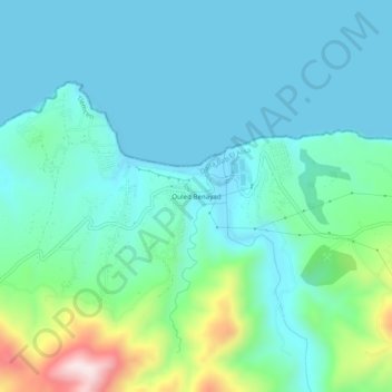
Name: Ouled Benayad topographic map, elevation, terrain.
Location: Ouled Benayad, Souk Tlata, Daïra Bab El Assa, Tlemcen, Algérie (35.04763 -2.02676 35.08763 -1.98676)
Average elevation: 299 ft
Minimum elevation: 0 ft
Maximum elevation: 1,542 ft