
Bad Schmiedeberg topographic map
Interactive map
Click on the map to display elevation.
About this map
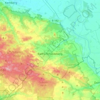
Name: Bad Schmiedeberg topographic map, elevation, terrain.
Location: Bad Schmiedeberg, Wittenberg, Saksen-Anhalt, 06905, Duitsland (51.61100 12.60763 51.77779 12.84554)
Average elevation: 351 ft
Minimum elevation: 217 ft
Maximum elevation: 627 ft