
Thank you for supporting this site ❤️
Make a donation
Make a donation
Gear up for your next adventure:
As an Amazon Associate, this site earns from qualifying purchases at no extra cost to you.
Gravedona topographic map
Click on the map to display elevation.
Thank you for supporting this site ❤️
Make a donation
Make a donation
Gear up for your next adventure:
As an Amazon Associate, this site earns from qualifying purchases at no extra cost to you.
About this map
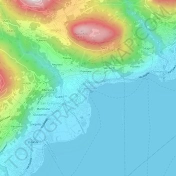
Name: Gravedona topographic map, elevation, terrain.
Location: Gravedona, Gravedona ed Uniti, Como, Lombardy, 22015, Italy (46.12719 9.28526 46.16719 9.32526)
Average elevation: 1,184 ft
Minimum elevation: 646 ft
Maximum elevation: 3,018 ft
Thank you for supporting this site ❤️
Make a donation
Make a donation
Gear up for your next adventure:
As an Amazon Associate, this site earns from qualifying purchases at no extra cost to you.