
Thank you for supporting this site ❤️
Make a donation
Make a donation
Gear up for your next adventure:
As an Amazon Associate, this site earns from qualifying purchases at no extra cost to you.
Erzberg topographic map
Click on the map to display elevation.
Thank you for supporting this site ❤️
Make a donation
Make a donation
Gear up for your next adventure:
As an Amazon Associate, this site earns from qualifying purchases at no extra cost to you.
About this map
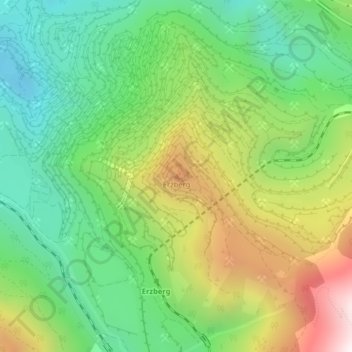
Name: Erzberg topographic map, elevation, terrain.
Location: Erzberg, Eisenerz, Bezirk Leoben, Styria, 8790, Austria (47.52439 14.91153 47.52449 14.91163)
Average elevation: 3,658 ft
Minimum elevation: 2,388 ft
Maximum elevation: 5,787 ft
Thank you for supporting this site ❤️
Make a donation
Make a donation
Gear up for your next adventure:
As an Amazon Associate, this site earns from qualifying purchases at no extra cost to you.