Geolocate

Moretonhampstead topographic map

Click on the map to display elevation.

About this map

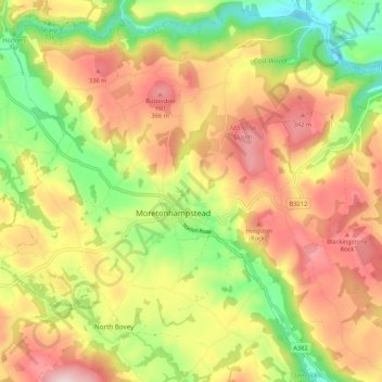
Name: Moretonhampstead topographic map, elevation, terrain.

Location: Moretonhampstead, Teignbridge, Devon, England, United Kingdom (50.63270 -3.81160 50.69719 -3.70524)

Average elevation: 778 ft

Minimum elevation: 262 ft

Maximum elevation: 1,276 ft

Gear up for your next adventure:

🛏️Cold Weather Sleeping Bag - Warm sleeping bag for cold conditions
🌡️Handheld Weather Meters - Measure wind, temp, and pressure for safe mountain travel
📶Vehicle Signal Boosters - Improve reception in rural areas while driving to trailheads
🪶Paracord Bracelet - Survival bracelet with built‑in tools
🧭Map Reading Tools - Tools and kits for map navigation

As an Amazon Associate, this site earns from qualifying purchases at no extra cost to you.