
Hindeloopen topographic map
Interactive map
Click on the map to display elevation.
About this map
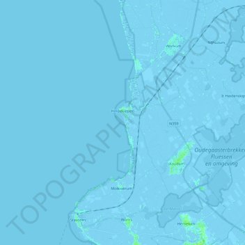
Name: Hindeloopen topographic map, elevation, terrain.
Location: Hindeloopen, Súdwest-Fryslân, Frisia, Netherlands (52.91208 5.21506 52.96007 5.43614)
Average elevation: -3 ft
Minimum elevation: -16 ft
Maximum elevation: 23 ft
Other topographic maps
Click on a map to view its topography, its elevation and its terrain.
Rottevalle
Rottevalle, Smallingerland, Frisia, Netherlands
Average elevation: 7 ft
Leeuwarden
Netherlands > Frisia > Leeuwarden
Leeuwarden, Frisia, Netherlands, 8911BR, Netherlands
Average elevation: 0 ft
Wolvega
Netherlands > Frisia > Wolvega > Wolvega
Wolvega, Weststellingwerf, Frisia, Netherlands, 8471JA, Netherlands
Average elevation: 3 ft
Schiermonnikoog
Netherlands > Frisia > Schiermonnikoog
Schiermonnikoog, Frisia, Netherlands
Average elevation: 0 ft
De Marne
Netherlands > Frisia > Schettens > Viersprong
De Marne, Viersprong, Schettens, Súdwest-Fryslân, Frisia, Netherlands, 8744 ES, Netherlands
Average elevation: -3 ft
Sneek
Netherlands > Frisia > Sneek > Sneek
Sneek, Súdwest-Fryslân, Frisia, Netherlands, 8601CL, Netherlands
Average elevation: 0 ft
Bolsward
Netherlands > Frisia > Bolsward > Bolsward
Bolsward, Súdwest-Fryslân, Frisia, Netherlands, 8701HZ, Netherlands
Average elevation: -3 ft