
Thank you for supporting this site ❤️
Make a donation
Make a donation
Gear up for your next adventure:
As an Amazon Associate, this site earns from qualifying purchases at no extra cost to you.
At-Bashy topographic map
Click on the map to display elevation.
Thank you for supporting this site ❤️
Make a donation
Make a donation
Gear up for your next adventure:
As an Amazon Associate, this site earns from qualifying purchases at no extra cost to you.
About this map
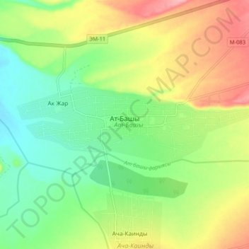
Name: At-Bashy topographic map, elevation, terrain.
Location: At-Bashy, At-Bashy District, Naryn Region, 722620, Kyrgyzstan (41.15970 75.77484 41.17805 75.85388)
Average elevation: 6,791 ft
Minimum elevation: 6,637 ft
Maximum elevation: 7,011 ft
Thank you for supporting this site ❤️
Make a donation
Make a donation
Gear up for your next adventure:
As an Amazon Associate, this site earns from qualifying purchases at no extra cost to you.
Other topographic maps
Click on a map to view its topography, its elevation and its terrain.