
Chorfa topographic map
Interactive map
Click on the map to display elevation.
About this map
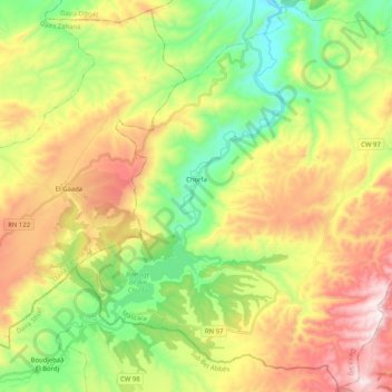
Name: Chorfa topographic map, elevation, terrain.
Location: Chorfa, Daïra Sig, Mascara, Algérie (35.34215 -0.30910 35.50453 -0.10449)
Average elevation: 1,273 ft
Minimum elevation: 230 ft
Maximum elevation: 2,713 ft
Other topographic maps
Click on a map to view its topography, its elevation and its terrain.