
Henderson topographic map
Interactive map
Click on the map to display elevation.
About this map
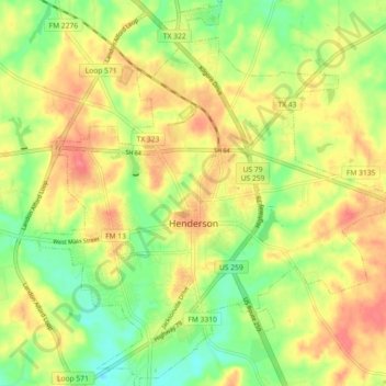
Name: Henderson topographic map, elevation, terrain.
Location: Henderson, Rusk County, Texas, 75652, United States (32.12074 -94.83580 32.19741 -94.75193)
Average elevation: 456 ft
Minimum elevation: 348 ft
Maximum elevation: 554 ft
Other topographic maps
Click on a map to view its topography, its elevation and its terrain.
Overton
United States > Texas > Rusk County
Overton, Rusk County, Texas, 75684, United States
Average elevation: 479 ft