
La Geria topographic map
Interactive map
Click on the map to display elevation.
About this map
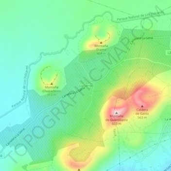
Name: La Geria topographic map, elevation, terrain.
Location: La Geria, Las Palmas, Canarias, 35571, España (28.94898 -13.73451 28.98898 -13.69451)
Average elevation: 1,066 ft
Minimum elevation: 679 ft
Maximum elevation: 1,959 ft