Geolocate

Gold topographic map

Click on the map to display elevation.

About this map

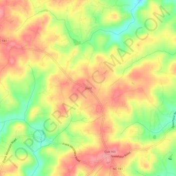
Name: Gold topographic map, elevation, terrain.

Location: Gold, Burke County, North Carolina, 28680, United States (35.77318 -81.78204 35.81318 -81.74204)

Average elevation: 1,211 ft

Minimum elevation: 1,030 ft

Maximum elevation: 1,339 ft

Burke County trails, hiking, mountain biking, running and outdoor activities

Other topographic maps

Click on a map to view its topography, its elevation and its terrain.

Rhodhiss

United States > North Carolina > Burke County

Average elevation: 1,050 ft

Hildebran

United States > North Carolina > Burke County

Average elevation: 1,112 ft

Glen Alpine

United States > North Carolina > Burke County

Average elevation: 1,138 ft

Gear up for your next adventure:

🚁Photography Drones - Capture stunning aerial views of landforms and topography
🛡️Insect Repellent - Protection against bugs during outdoor activities
🧭GPS Watch Accessories - Bands and chargers for GPS watches
🔌Solar Panel Charger - Charge gear sustainably outdoors
🧭Hiking Compass - Precision compass for reliable navigation in the wilderness

As an Amazon Associate, this site earns from qualifying purchases at no extra cost to you.