
دهستان حومه شهرکرد topographic map
Interactive map
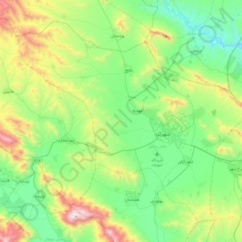
Click on the map to display elevation.
About this map
Name: دهستان حومه شهرکرد topographic map, elevation, terrain.
Average elevation: 7,313 ft
Minimum elevation: 5,928 ft
Maximum elevation: 10,869 ft
Other topographic maps
Click on a map to view its topography, its elevation and its terrain.
Farrokhshahr
Iran > Chaharmahal and Bakhtiyari Province > Sharekurd County
Farrokhshahr, بخش فرخ شهر, Sharekurd County, Chaharmahal and Bakhtiyari Province, Iran
Average elevation: 7,067 ft
Shahr-e Kord
Iran > Chaharmahal and Bakhtiyari Province > Sharekurd County
Shahr-e Kord, بخش مرکزی, Sharekurd County, Chaharmahal and Bakhtiyari Province, Iran
Average elevation: 6,896 ft