
Algeciras topographic map
Interactive map
Click on the map to display elevation.
About this map
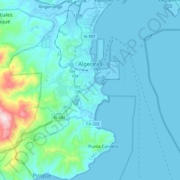
Name: Algeciras topographic map, elevation, terrain.
Location: Algeciras, Campo de Gibraltar, Cádiz, Andaluzia, Espanha (36.05020 -5.55110 36.17549 -5.42230)
Average elevation: 253 ft
Minimum elevation: -23 ft
Maximum elevation: 2,516 ft