
St.Jean topographic map
Interactive map
Click on the map to display elevation.
About this map
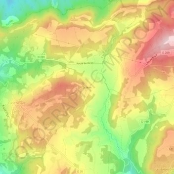
Name: St.Jean topographic map, elevation, terrain.
Average elevation: 1,699 ft
Minimum elevation: 1,138 ft
Maximum elevation: 2,178 ft
Other topographic maps
Click on a map to view its topography, its elevation and its terrain.
Caseneuve
France > Provence-Alpes-Côte d'Azur > Vaucluse > Caseneuve
Caseneuve, Apt, Vaucluse, Provence-Alpes-Côte d'Azur, France métropolitaine, 84750, France
Average elevation: 1,434 ft