
Lake Peachtree topographic map
Interactive map
Click on the map to display elevation.
About this map
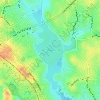
Name: Lake Peachtree topographic map, elevation, terrain.
Average elevation: 830 ft
Minimum elevation: 774 ft
Maximum elevation: 909 ft
Other topographic maps
Click on a map to view its topography, its elevation and its terrain.
Fernwood
United States > Georgia > Fayette County > Peachtree City
Fernwood, Peachtree City, Fayette County, Georgia, 30269, United States
Average elevation: 856 ft
Summer Brooke
United States > Georgia > Fayette County > Peachtree City
Summer Brooke, Peachtree City, Fayette County, Georgia, 30269, United States
Average elevation: 817 ft
Burnham Woods
United States > Georgia > Fayette County > Peachtree City > Burnham Woods
Burnham Woods, Peachtree City, Fayette County, Georgia, 30269, United States
Average elevation: 837 ft