
Colta topographic map
Interactive map
Click on the map to display elevation.
About this map
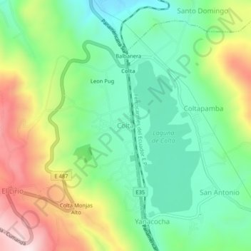
Name: Colta topographic map, elevation, terrain.
Location: Colta, Cajabamba, Colta, Chimborazo, 060410, Ecuador (-1.75499 -78.78234 -1.71499 -78.74234)
Average elevation: 11,152 ft
Minimum elevation: 10,558 ft
Maximum elevation: 12,192 ft