
San Gregorio Aztotoacan topographic map
Interactive map
Click on the map to display elevation.
About this map
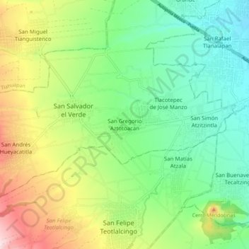
Name: San Gregorio Aztotoacan topographic map, elevation, terrain.
Average elevation: 7,848 ft
Minimum elevation: 7,441 ft
Maximum elevation: 8,609 ft
Other topographic maps
Click on a map to view its topography, its elevation and its terrain.
San Andrés Hueyacatitla
México > Puebla > San Salvador el Verde
San Andrés Hueyacatitla, San Salvador el Verde, Puebla, 74130, México
Average elevation: 8,225 ft
Iztaccíhuatl
México > Puebla > San Salvador el Verde
Iztaccíhuatl, San Salvador el Verde, Puebla, México
Average elevation: 15,525 ft
San Lucas el Grande
México > Puebla > San Salvador el Verde
San Lucas el Grande, San Salvador el Verde, Puebla, México
Average elevation: 7,687 ft