
Ouled Belil topographic map
Interactive map
Click on the map to display elevation.
About this map
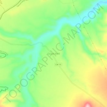
Name: Ouled Belil topographic map, elevation, terrain.
Location: Ouled Belil, Takhemaret, daïra Frenda, Tiaret, Algérie (35.25183 0.63267 35.29183 0.67267)
Average elevation: 1,637 ft
Minimum elevation: 1,365 ft
Maximum elevation: 2,034 ft
Other topographic maps
Click on a map to view its topography, its elevation and its terrain.
Bounoual
Algérie > Tiaret > daïra Frenda > Takhemaret > Bounoual
Bounoual, Takhemaret, daïra Frenda, Tiaret, Algérie
Average elevation: 1,768 ft