
Hillman Township topographic map
Interactive map
Click on the map to display elevation.
About this map
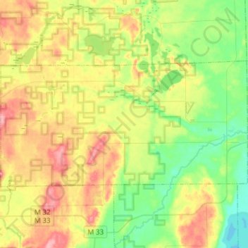
Name: Hillman Township topographic map, elevation, terrain.
Average elevation: 853 ft
Minimum elevation: 715 ft
Maximum elevation: 1,047 ft
Other topographic maps
Click on a map to view its topography, its elevation and its terrain.
Atlanta
United States > Michigan > Montmorency County
Atlanta, Briley Township, Montmorency County, Michigan, United States
Average elevation: 902 ft
Montmorency Township
United States > Michigan > Montmorency County
Montmorency Township, Montmorency County, Michigan, 40709, United States
Average elevation: 886 ft
Lewiston
United States > Michigan > Montmorency County
Lewiston, Albert Township, Montmorency County, Michigan, 49756, United States
Average elevation: 1,247 ft
Hillman
United States > Michigan > Montmorency County
Hillman, Hillman Township, Montmorency County, Michigan, United States
Average elevation: 768 ft